Blue Hill planning board weighs 10-lot village subdivision
Development on 5.7 acres abuts Post Office Trail
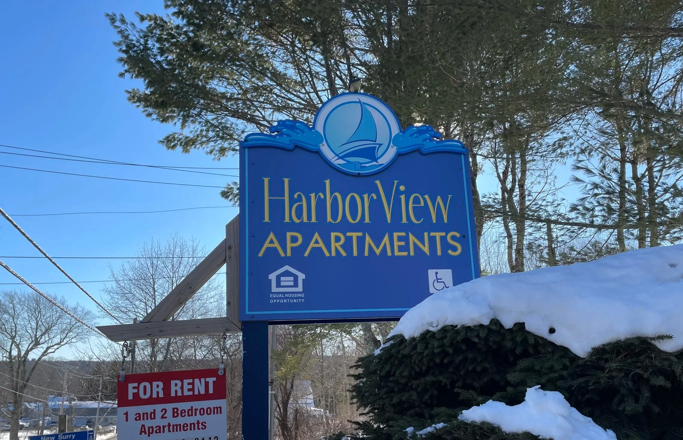
The development, called the Jonathan Fisher Fields Subdivision, would sit on 5.7 acres behind Harbor View Apartments. Photo by Tricia Thomas.
Feb. 18, 2026
By Tricia Thomas
BLUE HILL—A plan to subdivide a wooded, 5.7-acre parcel on Herrick Lane into 10 small housing lots received pushback from the Blue Hill planning board on Feb. 11.
The board rejected three of the 20 state criteria that the subdivision must meet to move forward, including those concerning ground water, water sufficiency and traffic. Another three of the 20 criteria were conditionally approved, pending the board’s receipt of more information or certifications from professionals.
Property owner Darrell Cooper did not comment on the rejections or conditional approvals, but told board members that he would work with his engineering firm to rectify their concerns.
Cooper, a South Portland resident who also owns the adjacent, 40-unit HarborView Apartments, wants to subdivide land behind the apartments and sell each of the 10 lots individually. The plan is called the Jonathan Fisher Fields Subdivision.
According to Cooper’s preliminary subdivision plan, lots would range in size from 3,009 to 6,785 square feet. Each lot would be large enough for a three-bedroom home and up to two vehicles, Cooper told the board on Feb. 11. Homeowners would access their lots via Herrick Lane, a private road off of Ellsworth Road that now is used by HarborView tenants and a handful of adjacent homeowners.
The review, called a “review for sufficiency,” is the latest step in the board’s consideration of the proposed subdivision. Cooper’s application underwent a successful cursory review for completion last October, and a public hearing on Jan. 14. At that hearing, several residents expressed concern about the subdivision’s proposed density, its use of groundwater for private wells, its impact on wetlands on and near the property, and its effect on traffic, said board chair Matthew Martin. The board also received “several written submissions” of concern, Martin added.
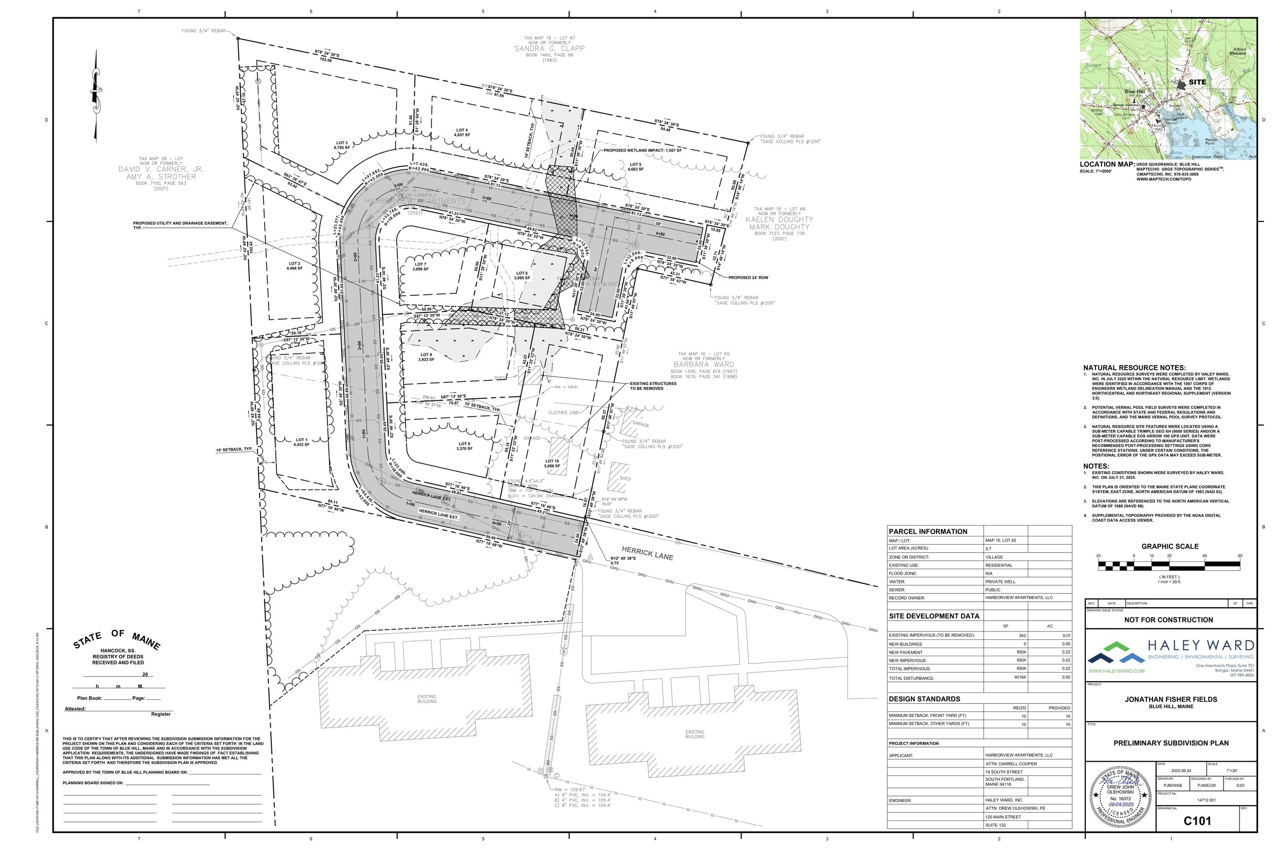
One property owner asked the planning board to ensure the development “be done thoughtfully in relation to the ‘oasis of wildness’” found at the abutting Post Office Trail that leads to Blue Hill Mountain. Site plan courtesy of the Blue Hill Planning Board.
David Carner, a Tuckers Lane resident, told the board in a letter that he was concerned about the proposed development’s density and its impact on the neighboring Post Office Trail, a hiking path that leads from the town’s post office to the base of Blue Hill Mountain. A majority of the trail, Carner said, is located on his land under a conservation easement with Blue Hill Heritage Trust, which allows public access.
“Our property has been under conservation easement through Blue Hill Heritage Trust since the 1990s. A majority of the trust’s Post Office Trail is located on it, so in a sense I not only look out for this property as its owner, but also as the steward of land that belongs to everyone who wishes to use it,” Carner wrote. “I am under no illusion that the property immediately adjacent to ours will remain undeveloped as Blue Hill grows and changes, but I also feel an obligation to advocate for that development to be done thoughtfully in relation to the ‘oasis of wildness’ that this trust property provides for the public right in the middle of Blue Hill.”
Tuckers Lane resident Christopher Marshall, a homebuilder whose property abuts Cooper’s, also wrote a letter opposing the development.
“I am aware of the aging and substandard housing stocks in the area and the need for new homes, yet I believe this subdivision is too high-density and is pushing the limits of what should be approved by the town regarding parcel size,” Marshall said in his letter. “My feeling is this would be a nice development with half the number of houses.”
Per protocol, public comment was not permitted during the board’s step-by-step review on Feb. 11, which took more than 90 minutes and included sometimes-lengthy discussions on each of the criteria.
“Tonight, what we are doing is proceeding to review the application and discuss the merits of the application as measured against 20 specific, individual criteria, such as pollution, sufficient water, traffic, wastewater management [and] things like that,” Martin explained before the board started its review.”
While not all of the 20 criteria applied to Cooper’s application, the board voted unanimously that the plan failed to meet criteria involving “sufficient water,” “traffic” and “ground water.”
During its discussion on water sufficiency, board members weighed whether either a large communal well or 10 individual wells would provide enough water for the homes without affecting neighboring wells. Cooper, whose plan includes a study of neighboring wells and their current output, said that a final decision on the number of wells to be dug has not yet been made.
Board vice chair Wilson King said that, according to public testimony, a “significant amount of people lost water during the [2025] drought,” and he was concerned about it happening again.
“I tend to believe that this can happen more frequently than not. So, I have a concern about that, and how much study we have regarding water consumption and water availability,” King said.
The board also rejected a similar criteria concerning groundwater, stating that the application failed to prove that the development would not adversely affect the quality or quantity of ground water.
“I think a hydrological study would address this, as well as the availability of ground water for the area and the availability of ground water for the subdivision itself,” Martin said.
The impact of additional vehicles, within the development and on both Herrick Lane and Ellsworth Road, also was discussed at length during the meeting. The Maine Department of Transportation has not yet signed off on the application, Martin said.
“I think that we should at least have seen the DOT application, if not the granted permit, before we sign off on this,” Martin said.
The board also asked Cooper to provide further evidence that the town’s wastewater treatment plant could adequately handle effluent from the 10 homes, that his engineer had not overlooked any existing stream or brook on or near the property, and that he had the “financial and technical capacity” to complete the project.
Additional documents that Cooper provides in response to the Feb. 11 meeting will be made available for public review, and another public hearing will be scheduled before the board makes a final decision, Martin said.
“The applicant has the ability to supplement, amend or otherwise alter their application to provide the additional materials we discussed,” Martin explained. “There will be an additional public hearing on any of those materials received.”
Cooper said in a texted response to questions on Feb. 17 that he is awaiting the board’s findings of fact, and will review them with his engineer.
“We will respond after reviewing the board’s request,” he said.